تقييم للأضرار في القطاع السكني: نحو 40 ألف وحدة سكنية متضرّرة خلال 35 يومًا فقط
تصعيد غير مسبوق: نحو 40 ألف وحدة سكنية متضرّرة خلال 35 يومًا فقط
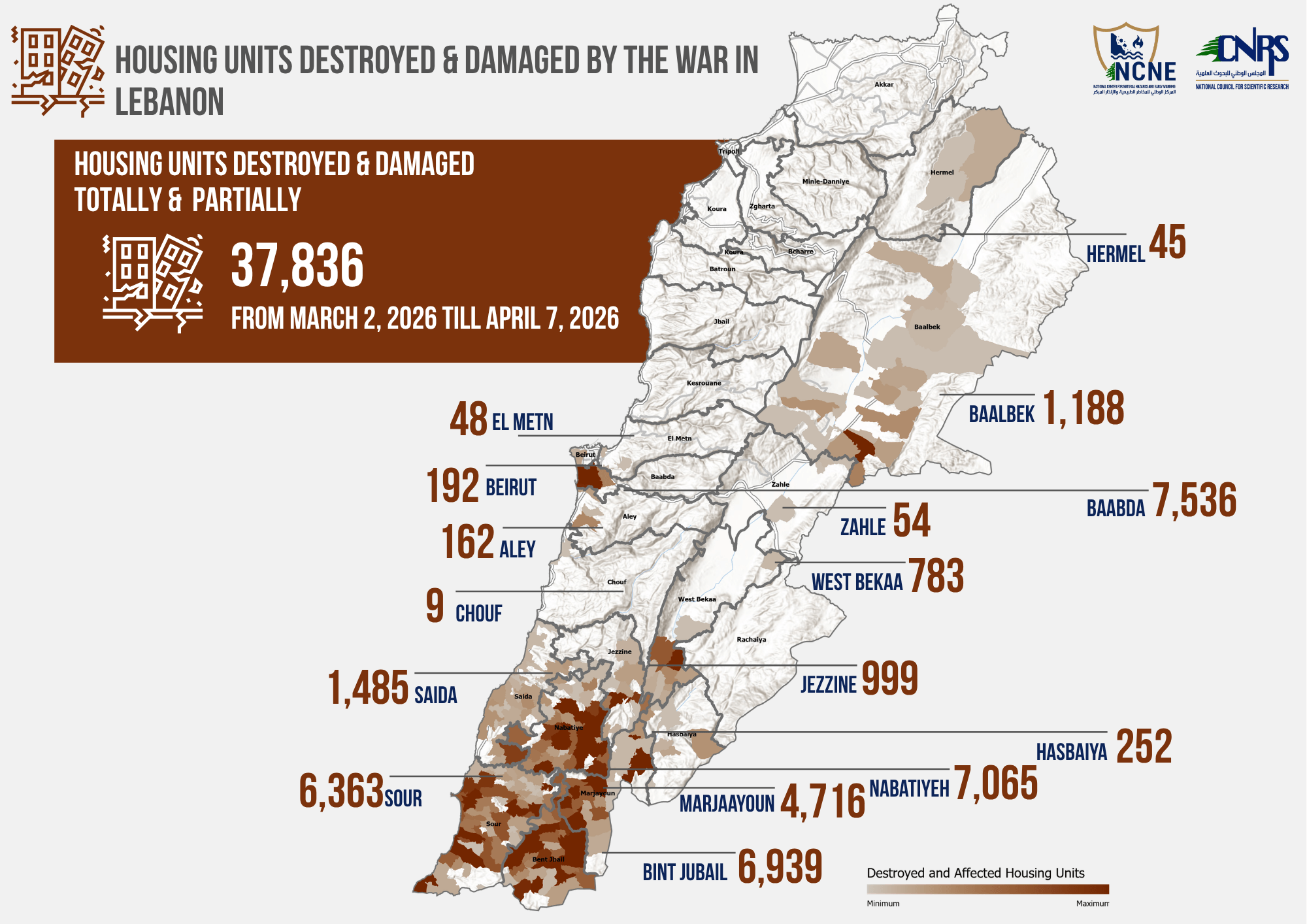
في إطار الجهود المتواصلة لرصد وتوثيق الدمار الممنهج والاعتداءات المتصاعدة على لبنان، يقدّم المجلس الوطني للبحوث العلمية – لبنان ، من خلال المركز الوطني للمخاطر الطبيعية والإنذار المبكر ، أحدث تقييم للأضرار في القطاع السكني
أبرز النتائج (خلال نحو 35 يومًا من التصعيد الأخير)
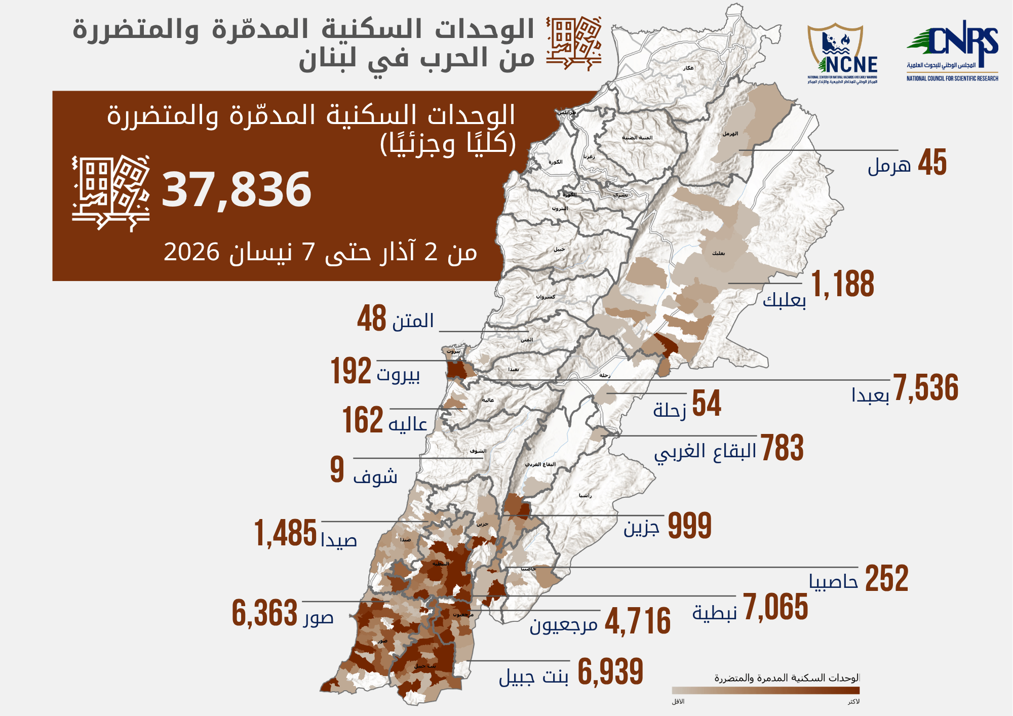
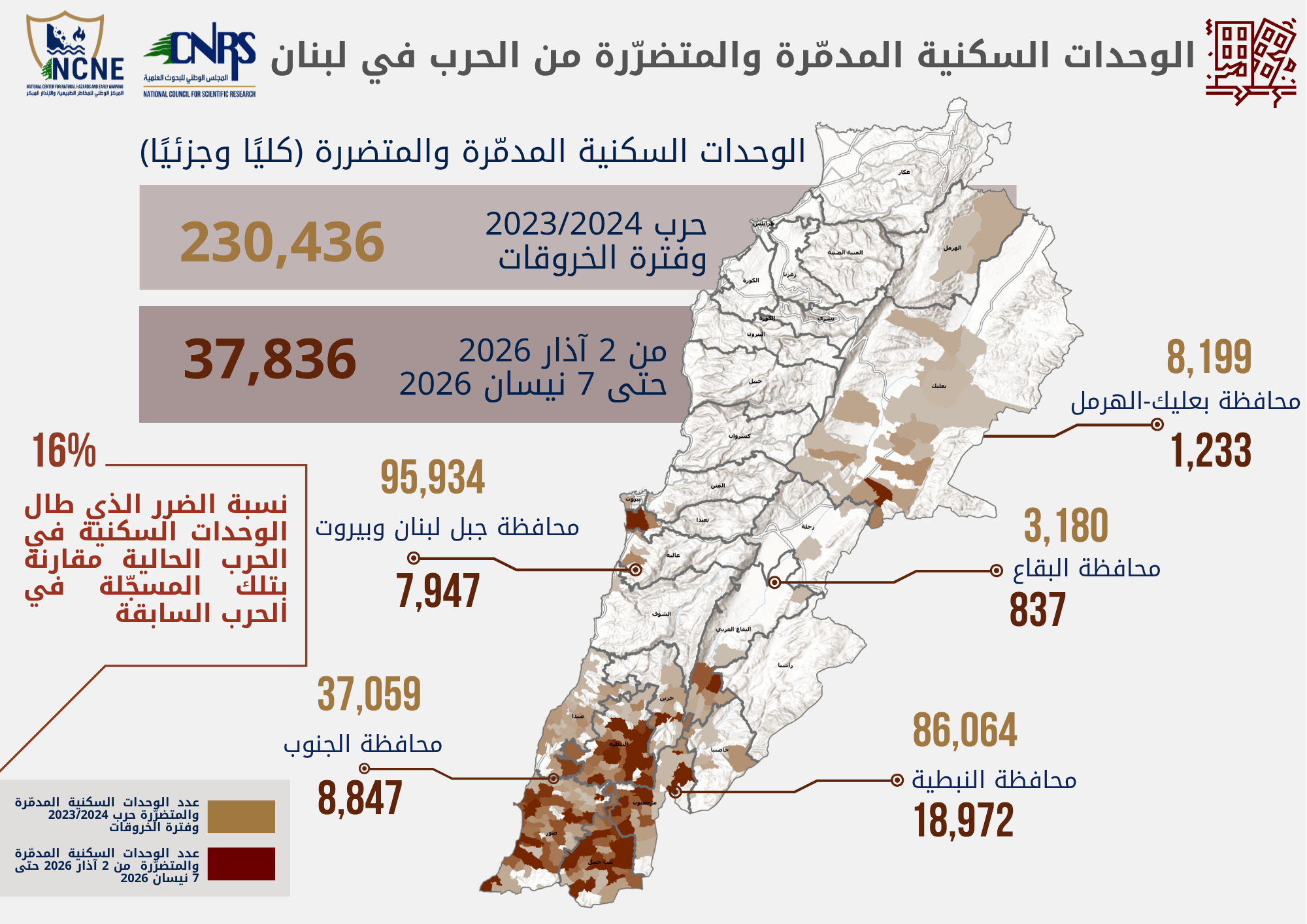
١. حوالي 40,000 وحدة سكنية مدمّرة كليًا أو متضرّرة بشكل كبير
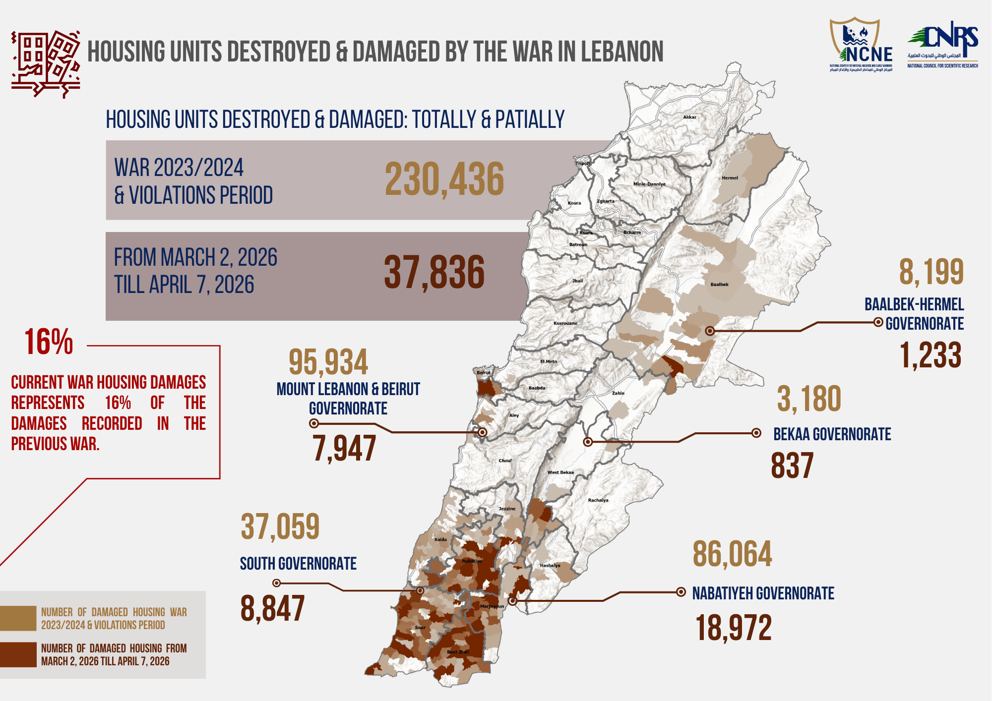
٢. يشكّل هذا الرقم حوالي 16% من إجمالي الأضرار المسجّلة خلال المراحل السابقة من الحرب
من تشرين الأول 2023 حتى 27 تشرين الثاني، ومن 27 تشرين الثاني حتى آذار 2026
المناطق الأكثر تضررًا
١. الضاحية الجنوبية لبيروت — الأعلى من حيث حجم الأضرار
٢. قضاء النبطية
٣. قضاء بنت جبيل
٤. قضاء صور
تعكس هذه الأرقام تسارعًا ملحوظًا في وتيرة الدمار، حيث سُجّل جزء كبير من الأضرار التراكمية خلال فترة زمنية قصيرة جدًا. و تستند هذه المعطيات إلى منصات الرصد الوطنية التابعة للمجلس، والتي تعتمد على الاستشعار عن بعد، والذكاء الاصطناعي، والمصادر المجتمعية (Crowdsourcing)، والتحقق الميداني، وتحليل البيانات المتقدّم، بما يضمن تقارير دقيقة قائمة على الأدلة
لا يقتصر هذا العمل على عرض الأرقام، بل يساهم في
١. دعم التقارير الوطنية والدولية
٢. توجيه التخطيط للتعافي المبني على الأدلة
٣. تعزيز المساءلة عبر التوثيق العلمي
٤. تنفيذ التقييم السريع للأضرار
Escalation snapshot: ~40,000 housing units damaged in just 35 days
Through its continuous efforts to monitor and document the aggressive and systematic destruction inflicted on Lebanon, the National Council for Scientific Research – Lebanon (CNRS-L), through the National Center for Natural Hazards and Early Warning (NCNE), presents the latest assessment of damages to the housing sector.
Key findings (latest ~35 days of escalation):
~40,000 housing units totally destroyed or heavily damaged
This accounts for approximately 16% of the total damage recorded during the previous phases of the war
(from October 2023 to November 27, and from November 27 to March 2026)
Most affected areas:
Southern Beirut Suburbs — highest concentration of damage
Caza Nabatieh
Caza Bint Jbeil
Caza Sour (Tyre)
These figures highlight a rapid intensification of destruction, with a significant proportion of cumulative war damage occurring within a very short period. The data is generated through CNRS-L’s national monitoring platforms, integrating remote sensing, AI, crowd sourcing, field verification, and advanced data analysis, ensuring robust and evidence-based reporting.